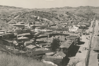

What did Mexican border towns look like in the past? Is there a way to reconstruct the visual past of these towns using popular imagery? The picture postcard is one way to rediscover that past. This project examines the use and application of photographic postcards to the historical geographic study of towns on the Mexican border. Arranged and analyzed systematically, picture postcards permit us to visualize a serial view of people and place thereby enhancing our understanding of changes in border towns.
Daniel D. Arreola is a cultural and historical geographer on the faculty of the School of Geographical Sciences and Urban Planning and an affiliate faculty in the School of Transborder Studies at Arizona State University. He was born and raised in Los Angeles, California, and he presently resides in Placitas, New Mexico. His books include The Mexican Border Cities: Landscape Anatomy and Place Personality (with James R. Curtis, University of Arizona Press, 1993), Tejano South Texas: A Mexican American Cultural Province (University of Texas Press, 2002), Hispanic Spaces, Latino Places: Community and Cultural Diversity in Contemporary America (edited, University of Texas Press, 2004), and Postcards from the Río Bravo Border: Picturing the Place, Placing the Picture, 1900s—1950s (University of Texas Press, 2013). Presently, Arreola is writing, Postcards from the Sonora Border:Visualizing Place through a Popular Lens, 1900s—1950s, the second installment in a multi-volume research project to document the visual history of Mexican border towns.